Feature Style Pages
When the Style Editor dialog is opened on a feature layer the following pages are available.
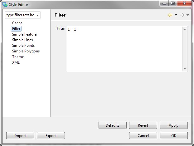
Filter
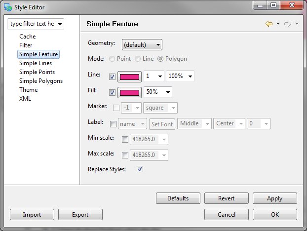
Simple Feature
Allows you to modify the feature using the old style Page and attribute selector - for a more advanced feature style editor choose the Simple Feature Type Page (see below) corresponding to the layer type you have selected.
Simple Lines
The Simple Lines Page is only available for Line feature layers. When you have a Line Feature Layer selected this will be the default Page displayed where you can update the style of the Line Layer.
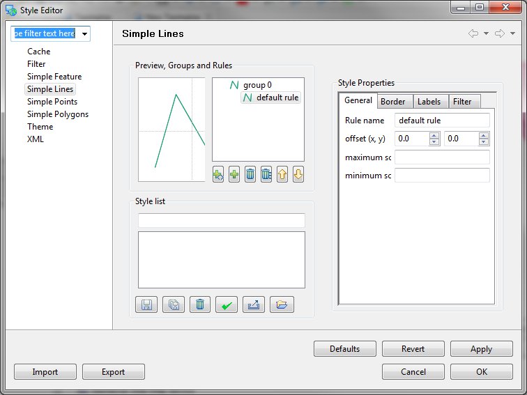
Preview, Groups and Rules
This area shows a preview of the current set of Rules associated with the Line Features.
Style Properties
This area (shown only when a Rule is selected) will allow you to change the General, Border, Labels and Filter Style.
Style List
Allows you to import and export styles which you use often.
Simple Points
The Simple Points Page is only available for Point feature layer. When you have a Points Feature Layer selected this will be the default Page displayed where you can update the style of the Points Layer.
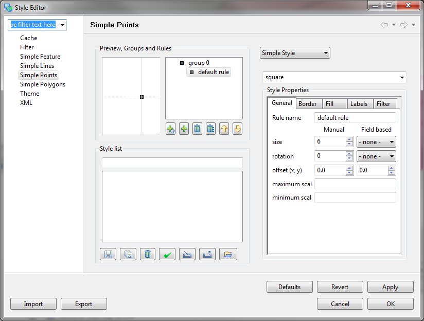
Preview, Groups and Rules
This area shows a preview of the current set of Rules associated with the Line Features.
Style Properties
This area (shown only when a Rule is selected) will allow you to change the General, Border, Fill, Labels and Filter Style.
Style List
Allows you to import and export styles which you use often.
Simple Polygons
The Simple Polygons Page is only available for Polygon feature layers. When you have a Polygon Feature Layer selected this will be the default Page displayed where you can update the style of the Polygon Layer.
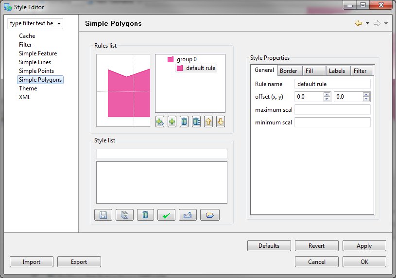
Preview, Groups and Rules
This area shows a preview of the current set of Rules associated with the Line Features.
Style Properties
This area (shown only when a Rule is selected) will allow you to change the General, Border, Fill, Labels and Filter Style.
Style List
Allows you to import and export styles which you use often.
Theme
Allows you to choose from a selection of predefined theme’s.
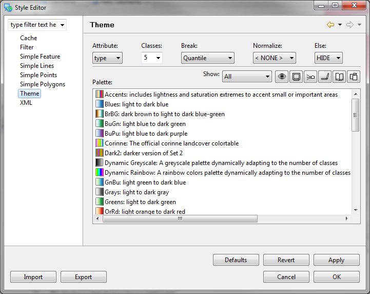
Category Definition
- Attribute: attribute used to define the categories
- Classes: number of classes to categories the data into
- Break: how to distributed the data into classes
- Quantile: All classes have the same number of elements
- Equal Interval: All classes have the same value range
- Normalize: Attribute used to normalize the attribute. As an example POP_CNTRY may be normalized by SQKM to determine population density
- Else: how to handle data values that cannot be categorized, often due to an invalid value.
Color Brewer Palette Selection
The uDig application includes palettes defined by the color brewer project. These palettes have been experimentally tested on live subjects.
- Show:
- Numerical / Sequential: palettes suitable for numeric values, a sequence of colors is used in order to communicate a smooth range of data. Higher values are brought to the attention of the eye.
- Numerical / Diverging: palettes suitable for numerical values, a diverging sequence of colors is used in order to emphasis the high and low values.
- Categorical: palettes suitable for categorical data, no value stands out more than any other.
- Filters: palettes may be filter into those suitable for color blind, CRT monitors, LCD monitors, Projectors, the printed page and photocopying.
- Palette: choose a palette from the list
Theme
- Opacity: used to set how much color is shown, the default of 50% is interesting when used over top of satellite imagery, a higher value is recommended for presentation or printing.
- Reverse: reverse the order of the theme
- Remove: remove the selected category
- Suitability: quickly check for any warnings
- Theme:
- Color: You can manually change the color for a category
- Label: You can change the label used to represent this category in the Legend Map Graphic
- Values: You can change the range of values for which this category is applied